Drainage Assessment and Its Role in Flood Risk Planning
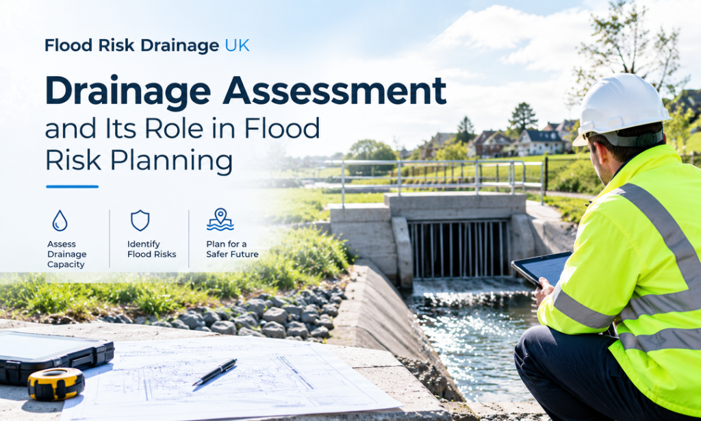
Flood risk around a development can change with rainfall intensity, ground levels, existing drainage conditions and natural surface water pathways. A drainage assessment examines these factors to understand how water may move across or collect on a site. Another important aspect that is analyzed during a drainage assessment is the ability of the current drainage system to cope with any runoff. Assessing these conditions early can support better surface water management and help inform suitable drainage measures.
What Does a Drainage Assessment Examine?
The drainage assessment determines the movement of water within the site through factors such as the levels of the ground, the soil profile, water courses currently on site and possible drainage routes for the water. It helps identify areas where water could collect or move toward neighbouring land during heavy rainfall.
The assessment also reviews the capacity and condition of the drainage system, including existing pipes, channels, storage features and discharge points. This helps determine whether current arrangements can manage expected runoff and highlights where improvements or additional measures may be needed as part of development planning.
When Is a Drainage Assessment Needed?
A drainage assessment may be needed for developments that could change surface water flow, increase runoff or affect existing drainage arrangements. Let’s understand why these assessments are needed:
- New Residential Developments: A drainage assessment may be necessary when creating plans for new homes, housing schemes or other larger-scale residential developments. Moreover, the assessment will look at the surface water that currently exists and help establish the impact that the proposed development may have on drainage.
- Commercial or Industrial Projects: Commercial structures, factories and industrial developments can add hard surface area in the form of roofs, roads and parking lots. Assessing drainage requirements can help identify suitable ways to manage additional runoff and reduce surface water concerns.
- Sites With Existing Flood Concerns: An assessment can be useful where a site has experienced surface water flooding, ponding or drainage problems. Moreover, flood risk & drainage consultants can help identify potential flow routes and areas requiring additional consideration during planning.
- Planning and Drainage Design: Professional advice can be valuable when drainage information is needed to support a planning application or development proposal. A drainage consultancy can assess site conditions and provide relevant technical input, while flood risk & drainage consultants can help develop appropriate surface water management measures.
How Does Drainage Assessment Identify Surface Water Flood Risk?
Rainfall, ground conditions, site levels, runoff, and drainage capacity all affect the risk of surface water flooding. To determine possible flooding channels and management needs, a thorough study looks at these variables.
Examining Existing Drainage Capacity
A drainage assessment examines the existing arrangements that collect, carry, store, and discharge rainfall from a site. It takes into account existing pipes, channels, soakaways and other drainage features to see if they are capable of coping with the expected rainfall. If pipes or channels cannot carry incoming runoff quickly enough, water may back up and appear on the surface. They are inspected for condition, size, capacity and connection points to look for restrictions. This will help to determine if water may pool during heavy rains and identify areas where poor drainage could lead to surface water flooding.
Understanding Ground Conditions and Runoff
The rate at which rainfall becomes surface runoff is influenced by ground conditions. Soil permeability, existing surfaces, site levels, slopes, and building and paving surfaces are all taken into account. Where infiltration is limited, greater volumes of water may remain on the surface. Increasing impermeable areas without suitable drainage measures can change the amount and direction of runoff. Understanding existing ground conditions therefore helps identify potential surface water flood pathways and supports the development of appropriate drainage solutions.
Assessing Surface Water Flow Paths
Site levels are assessed alongside the drainage network to understand how water is likely to move across the area during heavy rainfall. Overland flow can be affected by low points, slopes, boundaries, access routes and surrounding land. These potential pathways can be mapped to identify areas where water can collect or flow through a development. It can also indicate if proposed buildings, landscaping or other changes would block existing flow routes and increase surface water exposure elsewhere. By understanding the likely movement of water before development takes place, potential problems can be identified earlier and incorporated into the design process.
Considering Rainfall and Flood Scenarios
Surface water risk can vary depending on the rainfall conditions. Rainfall intensity, duration, and flood scenarios may be considered by drainage professionals to gain insight into the response of a site during severe weather. Drainage assessments therefore consider relevant rainfall conditions and flood scenarios when evaluating how a site may respond. This information with the help of expert drainage consultancy is used to inform practical considerations of drainage capacity, storage areas, finished floor levels and actions that can mitigate potential flooding impacts.
Recommending Suitable Risk Reduction Measures
Assessment results can be used to create measures that are appropriate to the site’s characteristics by a drainage consultancy. Additional storage, conveyance, permeable surfaces, controlled discharge and sustainable drainage features may be recommended depending on identified risks. Flood risk & drainage consultants may also take into account the impact of the proposed development on neighbouring areas. The assessment integrates site information, runoff assessment, drainage capacity and flood scenarios to give a foundation for managing surface water risk.
Final Words
To sum up, a detailed assessment helps identify surface water pathways, areas where runoff may collect and factors that could increase flood risk around a development. It also supports decisions about drainage design, water storage and discharge. Working with a drainage consultancy can provide practical input throughout the planning process. Thus, experienced flood risk & drainage consultants can assess site conditions and help develop measures for effective surface water management.