River Don Flooding and the Factors Behind Local Flood Risk
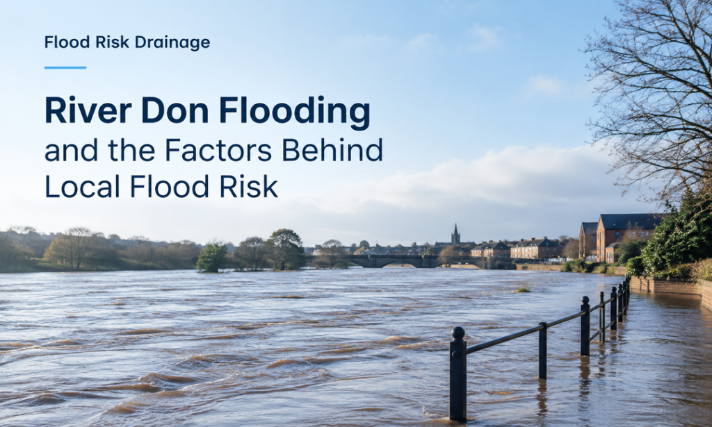
River Don originates from the Peak District and runs for about 70 miles, passing through Sheffield, Rotherham, and Doncaster, until it joins the Yorkshire Ouse. The varying geography of the river is crucial in determining the flooding conditions in the area, since the steep headwaters of the Pennines can react to heavy rain, whereas the Carrland areas of Doncaster drain slowly. River Don Flooding has repeatedly affected communities along its route, with major events recorded in Sheffield in 2007 and Fishlake in 2019.
What Contributes to Flooding on the River Don?
Several natural and geographical factors contribute to River Don Flooding. The river’s Pennine headwaters lie on steep, rain-soaked moorland by allowing intense rainfall to reach the river quickly and raise water levels within hours. Along the way, it receives several tributaries, such as the Little Don, Loxley, Rivelin, Sheaf, Rother and Dearne. The land is flatter and drains less downstream, especially around Doncaster. These contrasting conditions influence Flood Risk across different parts of the catchment, with some areas experiencing rapid rises while others may remain flooded for longer periods.
- Heavy rainfall can rapidly raise river levels across the steep Pennine headwaters.
- Steep terrain encourages faster runoff into the River Don.
- Tributaries add further water to the main river.
- Low-lying land around Doncaster drains more slowly.
Understanding Past Flooding on the River Don
Past flooding provides valuable insight into conditions along the river don. Major events in 2007 and 2019 demonstrate how rainfall, rising river levels and local geography can contribute to River Don Flooding and changing flood risk.
- The River Don experienced a significant flood in 2007, when there was heavy rain in Sheffield and the surrounding area. The Environment Agency reported widespread flooding throughout the catchment in June 2007, which is a significant reference date for flood conditions.
- In November 2019, River Don Flooding was again notable, with prolonged rainfall leading to river levels rising in parts of South Yorkshire. Sheffield had significant rainfall during the event, which caused flooding in a number of places.
- In 2019, Fishlake had significant flooding, with water levels in the town reaching very high levels, causing damage to homes and infrastructure. The event emphasized the vulnerability of communities located near the river.
- Past flooding helps explain present-day Flood Risk along the catchment. Previous events and current river-level monitoring and flood-warning data are valuable records for understanding where flooding may occur when river levels rise.
What Areas Are Vulnerable to River Don Flooding?
The risk of flooding along the river don is dependent on the local topography, rainfall and distance from the river. Low-lying areas can also be flooded through Sheffield and Rotherham as water rises. Further downstream, the floodplain around Doncaster is wider, and flooding can occur for longer durations and impact properties, roads and surrounding land at Barnby Dun, Stainforth and Fishlake. Let’s look at the key areas:
| Settlement | Reach | Dominant Flood Risk | EA Warning / Alert Coverage |
| Stocksbridge & Deepcar | Upper Don (Pennine headwaters) | Fast fluvial response to moorland rain | Upper River Don catchment flood alert area |
| Oughtibridge | Upper Don | Fluvial, out-of-bank onto low-lying gardens | Waterside Gardens flood warning area |
| Sheffield (Brightside, Attercliffe, Hillsborough, Meadowhall) | Lower Don Valley | Fluvial, backing up through culverted tributaries and industrial ground | Middle River Don catchment flood alert area |
| Rotherham (Ickles, Eastwood, Parkgate, Masbrough) | Middle Don | Fluvial, out-of-bank through the town centre and retail sites | Rotherham Central & Northfield/Steel? Anns/Parkgate/Rectal World warning areas |
| Sprotbrough | Middle–lower Don | Fluvial, riverside properties and gardens | River Don at Lower Sprotbrough warning area |
| Doncaster town centre & Bentley | Lower Don | Fluvial, town centre and low-lying suburbs | Lower River Don catchment flood alert area |
| Barnby Dun | Lower Don | Fluvial, low-lying roads and property | River Don at Barnby Dun warning area |
| Kirk Bramwith & South Bramwith | Lower Don (Carrland) | Fluvial, slow-draining farmland and villages | Kirk Bramwith & South Bramwith warning areas |
| Stainforth | Lower Don (Carrland) | Fluvial, low-lying estate adjoining the river | River Don at Stainforth warning area |
| Fishlake | Lower Don (Carrland), near the Ouse confluence | Fluvial, long-duration flooding once defences are overtopped | River Don at Fishlake warning area |
Is Your Site Affected by the River Don’s Main River Status?
The River Don is designated as a Main River, meaning certain activities on or near its banks are regulated by the Environment Agency. If a site is close to the river, proposed construction, excavation or other works may require specific permission. Understanding the river’s designation can help identify the requirements before development begins.
- Permission May Be Required for Works Near the River: Any activities undertaken on or near the Main River, such as construction and excavations, which might affect the flow of the river, may require an environmental permit.
- 8 Metres Around the River Can Matter: For a non-tidal Main River, an environmental permit can be required for activities performed within an 8-metre radius around the riverbank, flood defences or culverts.
- Ordinary Watercourses Have Different Regulations: Other watercourses may require Ordinary Watercourse Consent through their respective Lead Local Flood Authority/Internal Drainage Board.
How We Support Flood Risk Assessment for the River Don
Development of the areas around the River Don should involve an analysis of the flood risk, drainage, and site characteristics. An analytical approach will allow for the identification of any restrictions that may be involved.
Understanding the Site and River Setting
Every river-don site has distinct features due to its particular location, adjacent waterways, elevations of the land, and neighboring development. Site levels are particularly are very important because even small differences in elevation can affect how water moves across an area. Moreover, reviewing these details provides a clearer understanding of the site’s existing conditions and helps establish which aspects require closer assessment as the project progresses.
Identifying Possible Flood Risks
Records, flood maps, river details, and surface water will allow us to see how River Don The assessment considers how these sources may interact with the proposed development and surrounding area. Available flood mapping, historical information, and relevant environmental data can be reviewed to understand the site’s potential exposure. This approach helps establish whether additional modelling, surveys, or supporting technical information may be appropriate for the site and its proposed use.
Assessing Site-Specific Conditions
A detailed Flood Risk review considers the site’s location, existing drainage arrangements, access, and potential effects of development. Site location, ground levels, existing buildings, access arrangements, proposed development levels, and surrounding drainage features can all be reviewed. The proposed layout is also considered to understand how it may interact with existing flood pathways or areas that could store water. Where relevant information identifies potential constraints, these can be explained within the assessment alongside considerations for the proposed scheme.
Considering Drainage Requirements
Flood risk and drainage services can bring together flood-risk information with drainage considerations, helping assess how surface water should be managed and whether the proposed development could alter existing flow routes. Existing drainage arrangements can be reviewed alongside the site’s ground conditions, surrounding watercourses, and proposed impermeable areas. The assessment can consider how development may change the movement of surface water and whether drainage measures are required.
Frequently Asked Questions
What factors can cause flooding along the River Don?
The River Don can flood when the river level rises above the channel capacity due to prolonged rainfall. Flows can also be increased by surface water, saturated ground, drainage restrictions and runoff from adjacent land and infrastructure, which can lead to increased pressure on adjacent land and infrastructure.
Which locations may be affected by River Don flooding?
Low-lying areas near the river and its tributaries may be subject to River Don flooding. The risk level at each site is dependent on ground levels, flood protection, drainage, river flows and the distance from watercourses.
What are the most significant historical floods on the River Don?
When assessing the risk of flooding around the River Don, it is helpful to take into account historical flood events. However, incidents in the past do not necessarily reflect current conditions and site-specific information and professional assessment should also be taken into account.
Does a site near the River Don need a flood risk assessment?
Depending on the location, type of development, and planning requirements, a flood risk assessment may be required for planning purposes for a site near the river. Professional Flood risk and drainage services can be used to evaluate site conditions and determine appropriate drainage solutions.