Flood Maps for Better Land Use and Construction Decisions
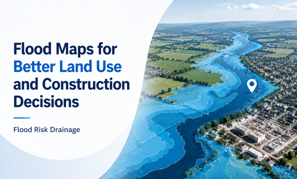
Approximately 6.3 million properties across England are currently at risk of flooding due to river, coastal, surface water, or any combination of these factors. In addition to that, there are thousands more properties that are prone to flooding by different means, and this figure is set to increase owing to global warming. Understanding whether your property lies within a flood zone has never been more important. Using a reliable flood map for planning and other flood-checking tools can help you assess risks early and take proactive steps to protect your home and prepare for future flooding events.
Understanding Flood Risk Maps and Their Importance
Interpreting flood risk maps is key to establishing the regions at risk of flooding and taking proper measures when it comes to development and protection of properties. These maps help determine whether a property falls within a flood zone by allowing homeowners, planners and developers to assess risks. Effective flood map planning supports safer construction and long-term resilience against the extreme weather events, helping communities reduce damage and prepare for future flooding issues.
- Flood risk maps identify properties located within any vulnerable flood zone.
- Effective flood map planning supports safer and smarter development decisions.
- Risk maps help engineers design good infrastructure against flooding events.
- Homeowners use maps to prepare and reduce potential damages.
- Accurate flood data supports sustainable growth amid climate change.
Comparing Flood Risk, Planning, and Forecast Maps in England
Maps provide a clear understanding of flood risks in your area and nearby regions. There are various methods available by the Environment Agency that will help people know about the probability of flooding in the long run. These tools also highlight how climate change may affect future risks, helping property owners and planners make decisions and prepare for potential flooding events.
Awareness leads to preparedness, which significantly reduces the impact of flooding events. Ultimately, flood maps are more than just other visual tools; they are important instruments for protecting lives, property and the environment. Through good decision-making based on information obtained through such maps, societies can ensure their resilience against the flooding.
- The long-term risk map shows flooding from multiple sources and supports an effective flood map for future resilience. It can also inform infrastructure measures, including foul drainage design, to improve flood protection.
- The flood map for planning enables developers to understand the probability of flooding and what flood zone an area belongs to prior to developing anything.
- The Environment Agency’s flood warnings map provides a five-day forecast across UK counties, displaying risk levels from very low to high for better preparedness.
The Importance of Foul Drainage Design in Flood-Prone Areas
Good drainage is important for areas that are prone to floods, as this will help prevent damage from occurring. Effective foul drainage design helps manage wastewater efficiently and strengthens the resilience of communities against flooding. Urbanization has likewise increased the demand for better management of drainage systems.
Poor drainage can lead to sewer overflows, contamination, and costly damage to properties and the environment. However, through the use of efficient drainage systems, these challenge can be easily managed. Thus, investing in effective foul drainage systems is an important step toward creating safer properties that are always prepared for the future challenges.
- In flood prone areas, it is important to have an effective foul drainage design to ensure efficient management of wastewater and to avoid sewer overflow during heavy rainfall. Moreover, good drainage systems always help minimize contamination hazards and promote safer and healthier communities.
- Engineers use a flood map for planning to help them understand potential hazards before designing any drainage network. Therefore, these maps are useful for identifying appropriate locations for drainage facilities and for meeting development requirements.
- When planning drainage solutions, it is important to determine if a property is located in a flood zone. More resilient systems, backflow prevention devices, and other protection measures are needed in areas that are more vulnerable to flooding to reduce damage from extreme weather events.
- Flood map planning is a key component of infrastructure. Right flood information can be used to incorporate sustainable drainage features, enhance water flow control and develop systems that can respond to future climate changes.
- A reliable flood warning map is useful to authorities and property owners to prepare for flood events. These predictions, when coupled with the effective drainage systems, enhance emergency response, safeguard investments and mitigate the environmental and economic consequences of flooding over time.
Final Words
To sum up, although both local council intervention and flood management plans can assist in risk reduction, there is no way to completely avoid floods. It is important to stay updated using the flood warnings map as well as consulting your local authority regarding how best to protect your property from the dangers posed by floods. Combining flood awareness with resilient infrastructure measures, including effective foul drainage design, can improve preparedness and reduce damage. Understanding residual risk ensures you remain proactive and better equipped for future flood events.