-
Pingback: How Sustainable Urban Drainage Systems Reduce Flood Risks | Flood Risk & Drainage Solutions
-
Pingback: What Is a Flood Zone? Everything Homeowners Need to Know | Flood Risk & Drainage Solutions
-
Pingback: How Good Drainage Design Prevents Flooding and Water Damage | Flood Risk & Drainage Solutions
-
Pingback: What Is a Flood Zone? Everything Homeowners Need to Know | Flood Risk & Drainage Solutions
Why the Flood Maps are Important in Safer Urban Planning
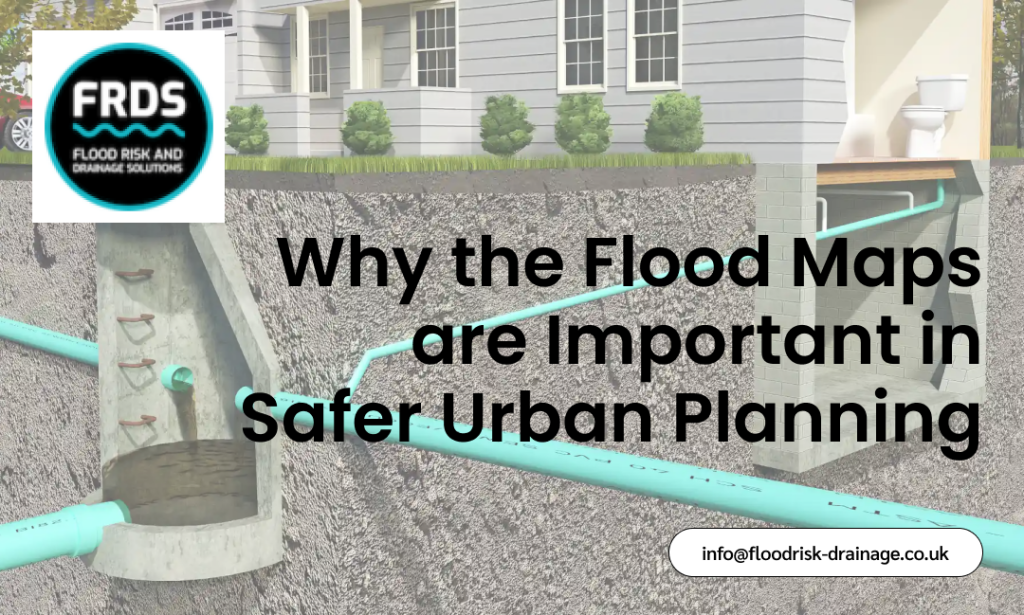
Floods have also been among the most devastating natural hazards, threatening lives, property, and urban infrastructure. It is very important to know the location of a flood to build resilient cities. Flood maps provide an understanding, helping planners, engineers, and also policymakers identify vulnerable regions, plan construction, and implement effective drainage and mitigation systems. SEPA flood maps are a necessary tool for identifying risky areas and developing cities safely. With flood information, cities will be able to minimize risks and promote smooth development.
The Role of Flood Maps in Urban Planning
Flood maps are crucial to developing safer and also more resilient sites. They enable planners and authorities to make decisions by providing detailed information on flood risks. Flood maps play an important role in urban planning in these ways:
Identifying High-Risk Areas:
The SEPA flood maps help planners identify areas likely to flood, including flood zones. It is important to identify these high-risk areas to prevent construction in hazardous areas and reduce future losses.
Guiding Infrastructure Development:
Flood maps inform the placement of key infrastructure, such as roads, bridges, and utilities. Planners will be able to focus on areas not prone to flooding, thereby protecting communities and minimising the cost of repairing properties during severe weather.
Protecting Critical Drainage Areas:
Flood maps mark essential drainage zones that should not be obstructed to ensure proper water flow. Maintaining these areas helps keep them waterlogged-free and aligns the land’s natural drainage systems to function effectively during heavy rains.
Supporting Policy and Regulation:
Information from the national flood risk assessment is incorporated into the flood maps that inform policy, building codes, and planning regulations. Moreover, governments can implement regulations to reduce flood risk, making new buildings safer and more stable.
Enhancing Emergency Preparedness:
Proper flood maps are used to design evacuation routes, flood barriers, and emergency response plans. Knowing the most vulnerable areas, communities, and emergency services will enable them to react promptly, decreasing the overall impact on life and property.
Benefits of Using Flood Maps in Urban Planning
Urban flooding is highly dangerous to people, infrastructure, and the economy. Planning with flood maps, one can help identify the flood zone 2 area and the key drainage area, ensuring safer and more resilient sites.
Identifying High-Risk Flood Zones
A flood map used in planning helps urban planners identify the most at-risk areas, including those in flood zone 2. Using SEPA flood maps, planners can visualise potential areas affected by water, and higher priority is given to safer locations for housing, commercial, and public infrastructure. Early warnings about areas prone to flooding will reduce long-term harm and ensure that resources are used effectively to minimise losses and help communities avoid frequent flooding.
Protecting Critical Drainage Areas
The problem of urban flooding is aggravated when the time-critical drainage areas are obstructed or invaded. Planning flood maps enables city authorities to identify key drainage areas and ensure they are not blocked. Conservation of these lands ensures a healthy flow of water during heavy rainfall, reduces waterlogging, and prevents damage to urban infrastructure. Including SEPA flood maps in development strategies can preserve natural drainage, which is very important in urban settings.
Informing Infrastructure and Construction Decisions
Flood maps can assist in planning the location of infrastructure, which is crucial for siting roads, bridges, and public buildings. Places in flood zone 2 or identified in national flood risk assessment reports can be avoided, and safer areas should be given preference in development. This helps cut maintenance expenses and reduce the risk of future flooding damage, and it also ensures that cities are built on a platform that can withstand severe weather and dynamic climate patterns.
Supporting Regulatory Compliance
The government uses SEPA flood maps and national flood risk assessment information to implement the urban planning regulations and building codes. An excellent flood map, well incorporated into the planning system, will ensure that the development complies with the guidelines, is not in high-risk areas, and is sustainable. Such a proactive strategy not only helps to secure people and property but also contributes to legal adherence and long-term resilience in urban areas.
Enhancing Disaster Preparedness and Response
Accurate flood maps in the planning process will help design emergency response plans, routes, and mitigation strategies to curb flooding. Planners will be able to equip the community before possible floods occur by learning about the organisation of flood zone 2 regions and drainage zones. Based on knowledge of SEPA flood maps and national flood risk assessment, responses are quicker and more efficient, with a few properties damaged and lives saved in the event of serious flooding.
Supporting Climate-Resilient Urban Growth
Planning a city based on a flood map would help authorities plan for the long-term effects of climate change. There are flood zone 2 areas and critical drainage areas that allow planners to design neighbourhoods that can withstand increased rainfall and extreme weather conditions. With the creation of SEPA flood maps and national flood risk assessment data, cities can prioritise the development of sustainable infrastructure. Thus, green spaces and flood mitigation systems are needed to ensure the resilience of urban growth and reduce future costs from flood damage.
Final Words
To sum up, flood maps are indispensable tools for developing safer, more resilient cities. They inform the decisions made by planners, policymakers, and communities by identifying vulnerable areas, helping them design infrastructure and establish effective evacuation strategies. Determining a critical drainage area is important for avoiding urban flooding and for development control. As climate patterns become increasingly unpredictable, the right use of flood maps can help urban areas prosper without incurring high risk. When well planned with all these insights, it not only saves lives and property but also promotes urban growth.