Avoid Flood Risks with a Smart Flood Risk Assessment Approach
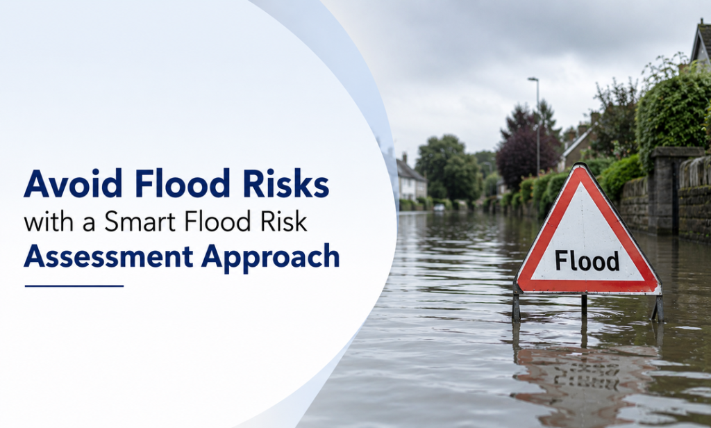
Flooding is a major risk to property and development schemes, leading to damage, delays and additional costs. Carrying out comprehensive flood risk assessments can help to mitigate risks associated with rivers, surface water, and drainage, ensuring that developments are safe and resilient. To mitigate flood risks in development projects, it is important to use the latest flood risk map for planning. However, this guide will help you to understand how a smart approach to flood risk assessments can safeguard your development.
When You Need a Flood Risk Assessment
Flood risk assessment is necessary for assessing the security and feasibility of any development project, especially in regions prone to flooding. These are the five main scenarios where a flood risk assessment is to be undertaken:
Sites in Flood Zones 2 or 3
It is important to conduct a flood risk assessment of your site if it is in a medium or high-risk flood area. Moreover, flood risk map for planning assists in identifying hazards posed by rivers, streams, and surface water, and your development also complies with local planning requirements. This is made possible by early assessment, which enables you to build your mitigation measures and prevent potential planning refusals.
Large Development Projects
Flood risk assessments are usually obligatory for sites of 1 hectare or more. Huge developments may completely alter the destructive nature of water movement across a site, exposing the site and downstream areas to flooding. A detailed evaluation provides developers with guidance on site layout and drainage design to reduce the effects of flooding.
Sites with Complex Drainage or Water Sources
If a property is impacted by multiple water sources, such as surface water, groundwater, or sewers, it is necessary to consult the most recent flood risk map when preparing a plan. This will identify all possible risks and solutions for the project, designed to reduce the risk of flooding.
When Local Planning Authorities Request
In certain circumstances, the local authorities might particularly insist that a flood risk assessment of your site should be provided as part of the planning application. The possibility exists regardless of whether the site is located outside the main flood areas; it may still be at risk, as noted in the council’s flood maps in planning or strategic studies.
Ensuring Compliance with Regulations
Lastly, developers must consider the planning and flood risk rules, as well as formal guidance, including Environment Agency flood maps for planning. Operating actively with such resources and professionals will ensure that all risks are resolved, approvals are more easily obtained, and developments are safe and long-term sustainable.
Key Elements of a Smart Flood Risk Assessment Approach
Adding the appropriate elements will yield an accurate assessment that aligns with the planning requirements. These are the five main aspects that can be considered:

Comprehensive Data Collection
The initial stage of a robust flood risk assessment is the adequate collection of data, which should encompass historical floods, rainfall, river heights and land uses. The combination of local surveys, satellite imagery, and GIS technology provides an accurate picture of areas prone to flooding. By collecting accurate environmental and topographical data, authorities and planners can easily determine vulnerable areas. Such a preventive action will enable a decision-maker to take steps that mitigate potential harm and safeguard communities in the event of a flood.
Advanced Modeling and Simulation
The application of the best computational tools improves the flood risk assessment process by simulating potential flood scenarios under various conditions. Models can consider the impacts of climate change, urbanization and natural drainage patterns. Planners can predict the development of floods and their relationships with infrastructure and settlements by testing different what-if scenarios. Such a predictive method can inform more informed policy decisions, emergency planning, and resource allocation and ultimately make communities better prepared for future floods.
Integration of Spatial Planning Tools
Planning a flood risk map is essential to sound land-use and infrastructure management. By including flood maps in urban planning, authorities can identify safe areas for development, establish evacuation routes and prioritize the development of safety measures. Planners can make strategic choices by visualizing the areas most susceptible to harm and determining building restrictions, zoning, and emergency response strategies. This combination of mapping tools will make new developments safer and ensure that existing structures are adequately protected against flood risks.
Continuous Monitoring and Updating
It is important to keep flood maps up to date to facilitate planning, since environmental conditions are dynamic and cityscapes evolve. Monitoring rainfall, river levels, and drainage systems in real time helps update flood maps. Frequent updates to flood risk assessments in planning will ensure that new developments, climate change, and infrastructure projects are captured in the risk assessment. Constant updates about flood risk assessment for floods will enable policymakers to intervene promptly, minimize vulnerability and make long-term flood management strategies more effective.
Collaborative Risk Management
Effective flood mitigation is achieved through the involvement of all stakeholders, including local governments, local community groups, and national-level agencies such as the Flood Risk Environment Agency. Teamwork is a sure way of having both professional knowledge and local experience play a role in risk assessment strategies. Planning helps enhance communication in emergencies, aligns matching infrastructure projects with safety objectives, and promotes community awareness. Multi-level cooperation can help authorities better prevent flooding and build resilience in these areas in the event of future flood threats.
Final Words
To sum up, an intelligent flood risk assessment method is critical for successful development, as it will help reduce risks and ensure compliance with planning and flood risk regulations. By actively seeking Environment Agency flood maps for planning purposes, you can make informed decisions and avoid costly delays. Begin your flood risk assessment early to protect your development, secure the future users and construct with confidence in a changing climate. Thus, a smart flood risk assessment approach combines data, modeling, mapping, collaboration, and continuous updates, ensuring communities are resilient and infrastructure is protected.